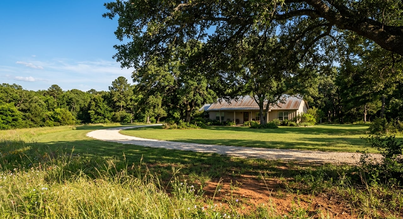
Looking at acreage around Rockdale and not sure where to start? You are not alone. Raw land can be a smart buy, but only if you check the right details up front. In this guide, you will learn a step-by-step way to evaluate tracts in Milam County so you avoid surprises and move forward with confidence. Let’s dive in.
Jurisdiction and zoning first
Before you fall in love with a property, confirm who regulates it. In Texas, cities handle most zoning, while counties have limited authority. Start by verifying whether the tract is inside Rockdale city limits, in Rockdale’s ETJ, or in unincorporated Milam County. Texas law limits county zoning powers, which is why this distinction matters. You can review the statute at the Texas Local Government Code Section 233.153 on county building regulations at law.justia.com.
If a parcel sits inside Rockdale city limits, check the city’s zoning district, permitted uses, setbacks, and building rules in the City of Rockdale zoning code. If it is outside the city, you will primarily work with Milam County on platting and driveway permits and follow state rules for septic. The Milam County Clerk is your hub for deeds, plats, and recorded easements.
Confirm legal access and roads
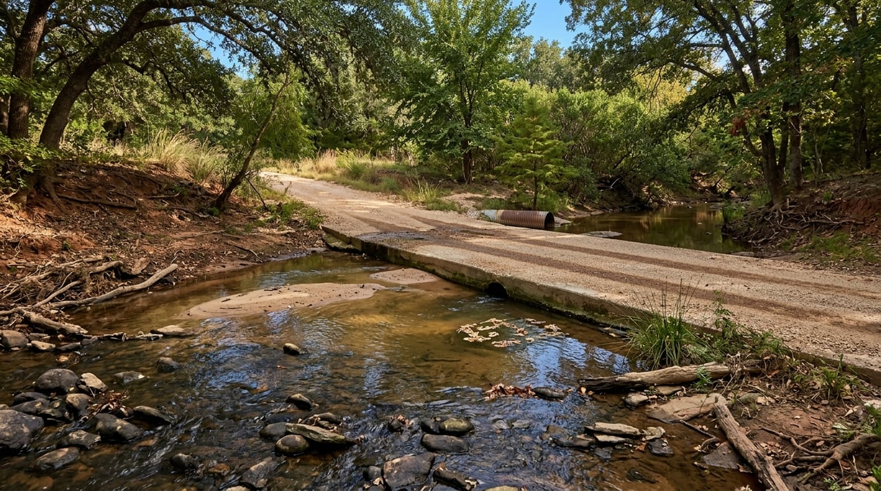
You need recorded, legal access, not just a friendly gate. Ask for the current deed and any easement documents and verify them with the county clerk. Identify whether the frontage is on a county-maintained road, a state highway, or a private easement. New entrances on state highways can require a TxDOT permit. County roads may require a driveway permit through the road and bridge office.
Red flags to avoid:
- Access that depends on a neighbor’s unrecorded promise.
- No clear ingress/egress easement on a landlocked tract.
- A refusal or restriction for a new highway entrance.
Map utilities early
A little homework here can save you thousands.
Electricity
Identify the provider that serves the road frontage and whether single-phase or three-phase power is available. In the Rockdale area, parts of Milam County are served by Bartlett Electric Cooperative. Call for line-extension estimates, pole easement requirements, and power availability along your road segment. Start with Bartlett Electric Cooperative.
Water service
Determine if a public water line is nearby. Southwest Milam Water Supply Corporation holds the local CCN in much of the Rockdale area. Use the PUC utility detail page to confirm the provider and then ask about meter availability and connection costs along your frontage, including Highway 79 corridors when relevant. See the PUC utility detail for Southwest Milam WSC.
Private wells
If no public line is feasible, study nearby well depths and historic water levels. The TWDB/USGS monitoring site near Rockdale provides useful local groundwater data you can use for expectations on drilling depth and seasonal levels. Review the USGS monitoring well data and ask for well logs and a recent pump test on any existing well.
Sewer and septic
Most rural tracts will require an on-site sewage facility. Check who issues OSSF permits locally and what the soil standards, setbacks, and drain-field sizes require. This ties directly to your soils and site plan.
Broadband and cell
Service varies in the country. Use provider address tools and ask your electric co-op about any fiber projects. If remote work is critical, verify this before you get too far.
Red flags to avoid:
- Long, costly line extensions for power or water.
- No viable broadband options.
- Soils or floodplain constraints that block septic approval.
Test soils and septic feasibility
Soils drive buildability, septic design, and even foundation choices. Run the parcel through the USDA NRCS Web Soil Survey and check the “Suitabilities and Limitations” reports for septic and building sites. Milam County includes sandy loams and heavier Blackland clays. The local Sandow series, for example, has characteristics that affect percolation and construction. Read the Sandow soil series description to understand how it may influence design and cost.
Plan to order a professional septic site evaluation during your option period. If you are building, a geotechnical review can help you choose the right foundation and avoid surprises.
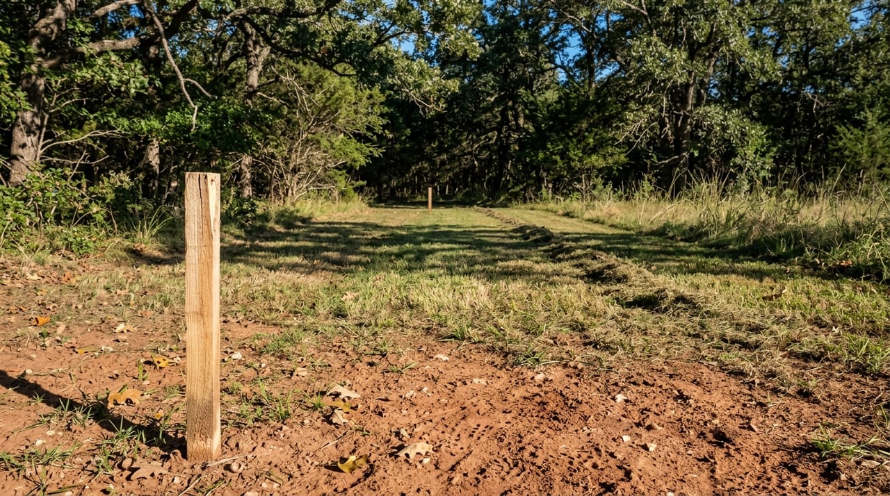
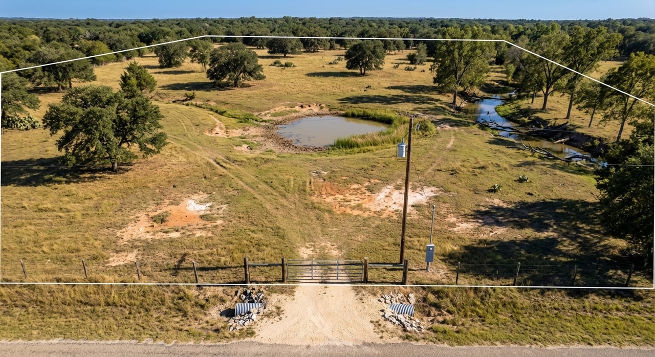
Study topography, drainage, and floodplain
Check FEMA Flood Insurance Rate Maps to see if any part of the tract lies in a mapped flood zone. Flood status can affect where you build, permitting, and insurance costs. Pull the maps at the FEMA Map Service Center and contact Rockdale’s floodplain administrator for local guidance. The Texas Floodplain Management Association lists local FPA contacts to help you get oriented; see Texas Floodplain Management basics.
On site, look for seasonal drainage paths, low benches, and signs of erosion. Steeper slopes can add road and erosion-control costs.
Red flags to avoid:
- FEMA floodplain over your planned homesite.
- Persistent standing water or recent channel migration.
Understand ag appraisal and taxes
Texas offers special open-space appraisals for qualifying agricultural, timber, or wildlife uses. This is not a true exemption. It is a productivity-based valuation that can reduce property taxes. Qualification standards, deadlines, and rollback rules vary by use and county. Read the Texas Comptroller’s guidance on ag, timber, and wildlife special appraisals at the Comptroller’s site, and check with the Milam County Appraisal District for local degree-of-intensity standards.
Key points:
- Confirm if the tract already has a special appraisal and what use maintains it.
- Ask about production history requirements and minimum acreage.
- Understand rollback taxes if you change the use.
Verify easements, minerals, and environmental history
Order a title commitment and review recorded documents for utility, pipeline, and access easements. The Milam County Clerk is your primary source for recorded easements, plats, and deeds.
Mineral ownership in Texas is often severed. Active or historic oil and gas activity can influence surface use. Search the Railroad Commission of Texas for historic fields, wells, and transfers in the Minerva–Rockdale area using the RRC docket index. Consider a mineral-rights report or title opinion if minerals matter to your plans.
If a tract borders historic industrial lands, review environmental records. When in doubt, order an environmental screening.
Watch local growth corridors
Rockdale has a long industrial history, and recent data center activity has repurposed former infrastructure. These projects can add power capacity, water, and fiber that may lift nearby land values, but they can also bring traffic or noise. For context, see Riot Platforms’ announcement about its Rockdale-site expansion and data center lease in the locality at Riot Platforms’ press release. Always confirm the exact location of any project relative to your tract rather than relying on county-wide claims.
Rockdale due diligence checklist
Use this list to keep your deal on track:
- Jurisdiction and zoning
- Verify city limits or ETJ vs county jurisdiction. If inside city limits, review the Rockdale zoning code.
- Title, survey, and access
- Ask the seller for the recorded deed, current survey, and any easement or ROW documents. Confirm access on record with the Milam County Clerk. Plan for a new title commitment and a current boundary survey before closing.
- Electricity
- Contact Bartlett Electric Cooperative to confirm service, line-extension costs, and phase availability.
- Water service
- Check the PUC utility detail for Southwest Milam WSC for provider coverage. Ask about meter availability and costs along your frontage.
- Private well planning
- Review the USGS monitoring well data for local depth and water-level trends. Obtain nearby well logs and a pump test for any existing well.
- Soils and septic
- Run the NRCS Web Soil Survey and order a professional OSSF site evaluation. Use soil-series info like the Sandow series to set design expectations.
- Floodplain and drainage
- Pull FEMA maps at the FEMA Map Service Center and consult Rockdale’s floodplain administrator. Reference basics at Texas Floodplain Management.
- Ag appraisal and taxes
- Review the Texas Comptroller guidance on special appraisals and rollback rules at the Comptroller’s site. Confirm local standards with the Milam CAD.
- Minerals and environmental history
- Search for oil and gas records at the Railroad Commission of Texas. Screen environmental records if the tract borders former industrial sites.
Suggested timeline and offer terms
- Option period: Order title, survey, and soil/septic site evaluation. Start utility availability and line-extension quotes in parallel.
- Weeks 2–4: Pull FEMA maps, confirm floodplain status, and complete well due diligence. Verify ag appraisal status and request tax estimates based on your planned use.
- Before closing: Resolve easement questions, confirm legal access, and review all title exceptions. Finalize utility costs and your site plan.
Ready to walk a tract?
If you want a second set of eyes on access, utilities, soils, or ag appraisal questions, our local team is happy to help you work through the checklist on a real property. Ranch House Real Estate is based in Rockdale and focused on rural land across Central Texas. Let’s grab a coffee and tour some land.
FAQs
What should I check first when buying raw land near Rockdale?
- Start with jurisdiction and zoning to see whether city or county rules apply, then confirm legal access and recorded easements with the Milam County Clerk.
How can I estimate well depth and water yield around Rockdale?
- Review nearby well logs and the TWDB/USGS local monitoring site for depth and seasonal water levels, then require a pump test for any existing or new well.
How do I know if septic will work on my Milam County tract?
- Run the parcel through the NRCS Web Soil Survey for limitations and order a professional OSSF site evaluation during your option period.
How do floodplains affect building a homestead near Rockdale?
- Use FEMA maps to identify any flood zones and coordinate with the local floodplain administrator, since mapped areas can affect where you build and insurance.
What is the Texas ag appraisal and how do I qualify in Milam County?
- It is a productivity-based valuation that can reduce taxes; review the Comptroller’s rules and confirm local degree-of-intensity standards and deadlines with the CAD.
Who provides electricity and water for rural tracts near Rockdale?
- Parts of Milam County are served by Bartlett Electric Cooperative for power and Southwest Milam WSC for water; confirm line location, capacity, and connection costs early.